Project Description
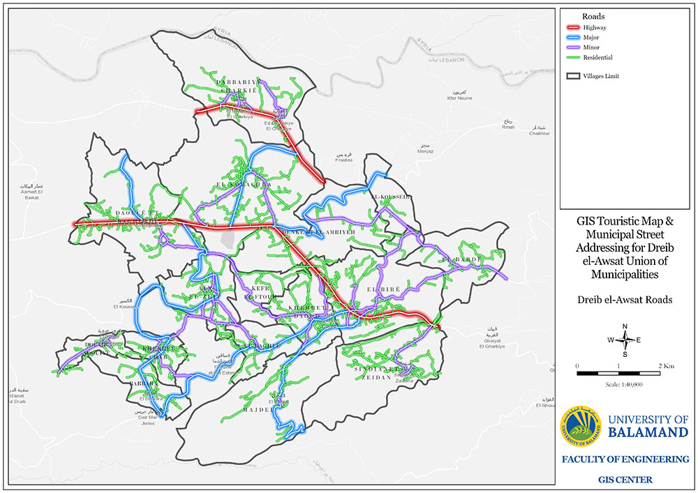
The overall objective of this project is to improve the institutional capacities, in the area of transparency and participation, of unions of municipalities in Akkar. The project is implement in collaboration with G8T Solution and it encompass four components: 1- GIS Street Addressing System, 2-Touristic Map, 3-Municipal Data Management System, 4- Web Portal.
Expected Outputs
- - Smart municipality
- - Street Centerline mapping using RTK GNSS receiver
- - Geocoding and Street Addressing
- - GIS Capacity building
- - Touristic Map to promote economic sustainably
- - Service improvement through a management system that includes incomes, budgeting, and expenses modules
- - Transparency improvement and inclusiveness through the citizen’s orders and transactions modules
- - Strengthen the union-management unit and archiving
Beneficiaries
- - Union of Municipalities of Dreib el-Awsat.