Project Description
The objective of this project is to develop a smart E-municipality through the development of a comprehensive spatial data infrastructure for the municipality using CAD, Satellite image, field mapping using GNSS RTK, and demographic data collection. It also requires the development of street and house addressing system. The GIS SDI is linked to a fully automated municipal management system developed by G8T solution.
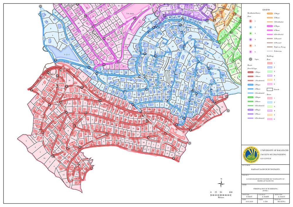
Expected Outputs
- - Spatial data Infrastructure ( Parcels, Building footprints, Streets centerline, Electricity lines, pipelines, Infrastructure, POI)
- - Geocoding, street and house numbering
- - Smart Municipal System
- - Improve Service provision
- - Strengthen the management unit
Beneficiaries
- - Mazraat Yachouh Municiplaity.