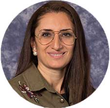
 MOHAMAD FNEICH
Mohamad Fneich is a highly skilled and experienced professional currently working as a Lead Solutions and Product Analyst at Esri Lebanon. He holds a Bachelor's degree in Surveying Engineering, as well as Master's degrees in Computer Science and GIS and Data Science.
With more than seven years of experience in GIS, software development, and teaching, Mohamad has established himself as an expert in these fields. His strong educational background and extensive work experience have allowed him to excel in his current role at Esri Lebanon, where he is responsible for providing solutions and analyzing products to meet the needs of clients.
 Gretta Kelzi
With 25+ years of experience in GIS systems and applications and managing projects
using predictive, hybrid and/or agile methodologies, including (not limited to)
: Proposal and Terms of Reference Drafting, project planning, requirements gathering
and analysis, data collection and processing, researching products and technologies,
system design and implementation, technical documentation, quality control, system
deployment, end-user training, customer support, and stakeholder management and
negotiation. Extensive experience in:
• Enterprise GIS solutions and applications: including system, application and Geodatabase
design and implementation, for governmental and non-governmental institutions.
• Design and conduct of Automated field operations: designing collection forms,
deploying workforce applications, monitoring field operations for Emergency response
operations and other business entities.
• Geodatabase implementation: for Lebanon coverage base maps and project specific
base maps and operational layers in the MENA region.
• Location Studies and Data analysis: for multiple sectors.
• Implementation of web based GIS applications using LC/NC: including design, collecting
requirements, QC/QA, testing, implementation and client support for many types of
clients.
• Products and Solutions Management: from elicitation of needs, planning, follow
up on development, preparing and execution of launching, monitoring performance,
using different method of measurements, and taking preventive/corrective actions.
• Special experience in: Banking Sector; Nonprofit Sector, Humanitarian and disaster
risk response and management ; Education Sector
 Mansour Raad
With over 30 years of experience in the IT and GIS industry, Mansour Raad is a Chief
Technologist and Lead Subject Matter Expert on Advanced Spatial Analytics using
Machine Learning and BigData at Esri. At Esri, Mansour has served as a team lead
in architecting and implementing product solutions for Esri, such as ArcIMS, ArcWeb,
ArcGIS for Flex, and currently GeoAnalytics and GeoAI solutions. He is also a regular
presenter during plenary sessions at various Esri conferences. In his role, he assists
commercial and government customers in implementing Big Data and Machine Learning
geospatial solutions, by leveraging state-of-the-art techniques for automatic digitization
of vector data and object recognition in raster data for further spatial statistical
analysis and visualization.
His recent body of work includes projects with a large telecommunication provider
in processing an enormous volume of calls data records for health crisis mitigation
and commercial store expansion based on aggregated user mobility. Also, he architected
the BigData backend for the KuwaitFinder mobile application for the Public Authority
for Civil Information in Kuwait for advanced geoprocessing using Machine Learning
in the production of spatial and temporal information. Mansour holds a Master's
degree in Aerospace Engineering from Boston University and frequently blogs on Big
Data and AI topics and shares innovative examples of geospatial implementations
at http://thunderheadxpler.blogspot.com.
Mansour owns the exclusive right to U.S. patents 7,962,624 and 7,080,120 (Title:
"System and method for collaborative processing of distributed applications").
In addition to working at Esri, he also serves as an adjunct faculty member at Johns
Hopkins University, where he teaches online advanced placement courses on "BigData
Analysis Tools and Techniques" and "Artificial Intelligence and Machine Learning
in Geospatial Technology."
Before joining Esri, he designed and implemented an airport noise and operations
monitoring system used in over 30 airports worldwide, and collaborated with the
US Navy to develop digital signal processing techniques that lead to improvements
in preventive maintenance for helicopter gearboxes.
When not physically on the Esri campus (or road biking), you find him speaking at
several domestic and international organizations and conferences regarding GIS,
BigData, and AI/ML including (and not limited to) the following:
• "Big data toolkit and Geo.AI," Esri GeoConX Conference, 2019, Atlanta, USA
• "Hidden GeoGems in BigData using ML," Esri Petroleum Conference, 2019, Houston,
USA
• "Demystifying Geo.AI," Abu Dhabi Digital Authority Symposium, 2018, Abu Dhabi,
UAE
• "Geospatial Temporal Analysis and Visualization," Spark Summit, 2015, New York,
USA Esri Author